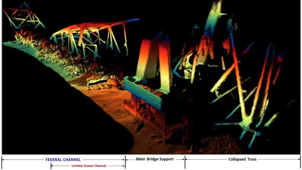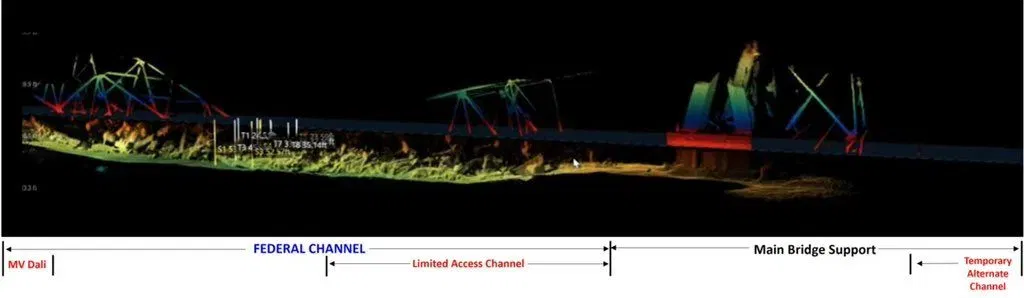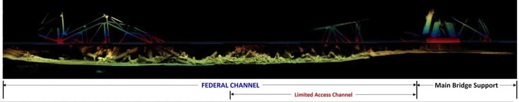
The U.S. Army Corps of Engineers in Baltimore has released new sonar images of the wreckage from the collapsed Francis Scott Key Bridge.
These sonar CODA (Compact Operational Deployable Automated) images, provided by the U.S. Navy’s Naval Sea Systems Command (NAVSEA) Supervisor of Salvage and Diving (SUPSALV), show bridge debris in the deepest part of the federal shipping channel and one of the Key Bridge’s main support structures.
In the images, the metal framework extending above the waterline is currently scheduled for removal by the end of April, according to USACE Baltimore officials. This will make way for a Limited Access Channel within the federal channel span, measuring 35 feet deep and 280 feet wide.
The Limited Access Channel will permit larger vessels, such as marine tugs, Maritime Administration (MARAD) ships, and those used for Roll-on/Roll-off shipping, to enter and exit the Port of Baltimore.
In a recent social media post, the U.S. Army Corps of Engineers in Baltimore stated that the numbers in the sonar images indicate depth and clearances from the wreckage to the surface.
Gov. Moore is scheduled to hold a press conference on Wednesday at 3 p.m. to provide updates on the developments in the cleanup and recovery efforts related to the Key Bridge collapse.